

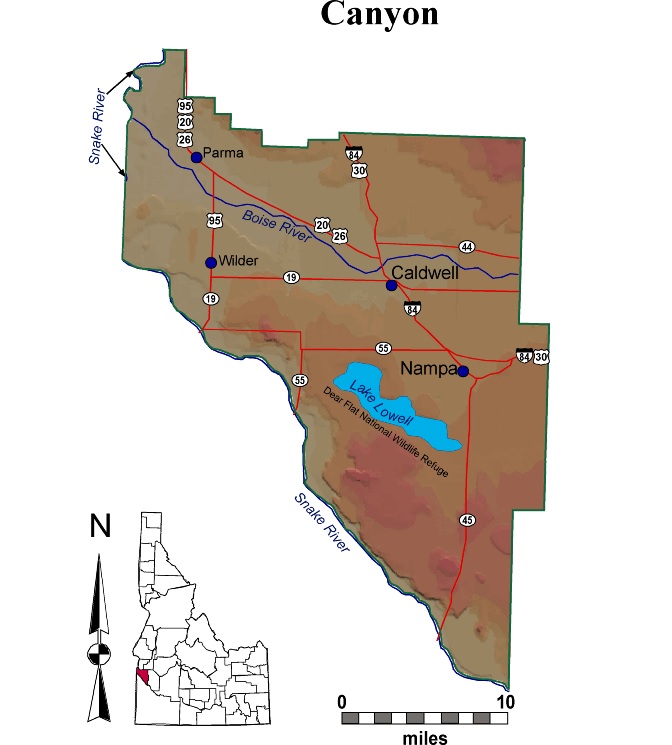
Canyon County
IDGenWeb

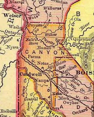
1895 Rand McNally Atlas
Courtesy of Digital Atlas of Idaho
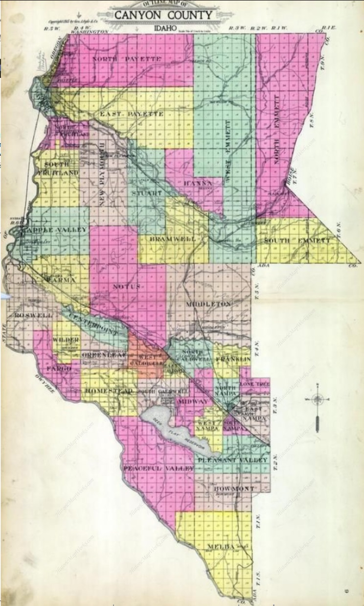
1915
Courtesy of HistoricMapWorks.com
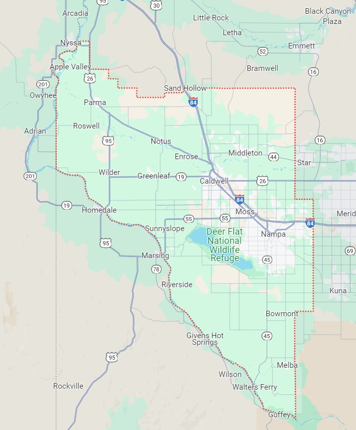
2023
Courtesy of Google
Apple Valley An Agricultural community. Named c. 1913 for the fine quality of apples grown here. Located at T6N R6W sec 24
Bernard Ferry Ferry on the Snake River 15 mi. S of Caldwell. Well known to early-day SW Idaho settlers; established in 1882 and named for James C. Bernard. It was run in competition with nearby Walters Ferry. Post Office (named Central), 1888. Located at T1N R3W
Big Willow Site of an early community in the NW part of the county. Post office, 1907- 1916.
Bowmont Village founded in 1911, located in the East part of the county just E of Highway 45 and 9 miles South of Nampa; noted for its potatoes, lettuce, onions, and clover seed. Named by its founder, J. F. Bow. Formerly named Newell. Located at T2N R2W sec 2
Bugtown Camp of the OSLRR in the 1880s, located one half mile south of present day Caldwell. A derogatory name, probably from the bugs that troubled many such camps. Also designated Caldwell at times. Located at T4N R3W sec 27
Byram Named for the only postmaster, Jessie P. Byram.
Caldwell County seat. Situated in the center of the county on the South shore of the Boise River. The Idaho and Oregon Land Improvement Company, of which Kansas U.S. Senator C. A. Caldwell was president, owned and platted the town site of Caldwell in 1883. Nicknames: Bugtown and Hamburg. Named for C. A. Caldwell. Located at T4N R3W sec 21/22
Callopy UPRR siding near Nampa. Named for T. C. Callopy, a train dispatcher. Located at T2N R1W sec 5
Dixie One of the earliest settlements in Boise Valley, on the South shore of the Boise River on the lower edge of Caldwell. Dixie Valley, a camp located near Caldwell, was mostly occupied by Missourians in about 1864. Many of the first settlers were southern sympathizers and so named their community Dixie or, as often called, Dixie Slough. (Note: there are two other towns in Idaho named Dixie, one in Idaho County and one in Elmore County)
Fort Boise Historic site near the confluence of Boise and Snake rivers 5 miles NE of Parma. First built as a temporary shelter in 1813 by John Reid, of the John Jacob Astor's Pacific Fur Company, in 1813 when he wintered here. The post was eliminated when he and nine of his men were killed by Indians in 1814. Donald McKenzie established a post for the North West Company at the same site in 1819. In 1832 Thomas McKay, of the Hudson's Bay Company, built an adobe fort on the East bank of the Snake River N of Reid's site. This became known as Fort Boise, for the river. In 1838 McKay was joined by Francois Payette, who managed the fort for nine years. The fort served Oregon Trail travelers until 1852. The next year flood waters destroyed the adobe fort, and a new, smaller one was erected in 1854, to be destroyed in 1862 by another flood. The site was subsequently used for a ferry. Located at T6N R6W sec 25
Greenleaf Town in central Canyon County halfway between Caldwell and Wilder. Founded in the early 1900s by a group of Quakers, who built their community around the Friends Church and the Greenleaf Academy, founded in 1908. The town incorporated in 1972. Post office, 1908 -. Located at T4N R4W sec 21
Hamburg Siding An early name for the community that became Caldwell. Also shortened to Hamburg. Named for the blacksmith shop of Jack Ham, at the place which is now First or Second and Aven streets. While the shop was moved to downtown Caldwell when the new town was laid out, the old name was still sometimes used for the townsite. Located at T3N R2W sec 16
Huston Town in central Canyon County halfway between Caldwell and Wilder. Founded in the early 1900s by a group of Quakers, who built their community around the Friends Church and the Greenleaf Academy, founded in 1908. The town incorporated in 1972. Post office, 1908-. Located at T3N R4W sec 11
Lemp An old BVTRR station in NW Canyon County on Smith Prairie. Post office, 1901- 1904. Located at 2150'. T4N R2W sec 3
Lizard Butte An erosion remnant left over a volcanic vent; an historic landmark just East of Snake River and Marsing, Owyhee County, and West of Deer Flat Reservoir. So named because it looks like a giant lizard with extended legs and reared head. When viewed from the West there is also a tail. Located at T3N R4W sec 35
Lower Boise Early settlement and post office on North side of Boise River, beginning about where Notus is and continuing down the valley to the mouth of the Boise River. Boise Ferry was established here before 1864: Post office, 1869-1901, when the name was changed to Lemp. The site of Lower Boise was destroyed by flood twice and each time was established with a different name. It has at different times been called Lemp, Parma, and Notus. Located at T6N R6W
Maddens A RR station on the UPRR. A farming community. Named for a prominent local farm family important in the early history of Caldwell, the Ross W. Maddens. Located at T4N R2W sec 29
McConnel Island Island South of Parma, in Boise River, settled by the four McConnel brothers; afforded pasturage and forage for cattle and horses when this was stock country. Located at T5N R5W sec 22
Melba Town on the UPRR in the SE part of the county, the center of a grain area. Post office, 1912-. Settled in 1912 as the Boise Project made water available to the area. Named for Melba Todd, daughter of C. C. Todd, the founder. Located at T1N R2W sec 36
Middleton Town in the NE part of the county halfway between Boise and Keeneys Ferry, near the junction of Boise and Snake rivers. A prominent stopping place on the Oregon Trail; the town site was filed in 1865, one of the older settlements in the state. Post office, 1866-. Located at T4N R2W sec 6/7
Moss A community about midway between Caldwell and Nampa on US 30. Named for A. B. Moss, a local rancher. Located at T3N R2W sec 8
Nampa The largest city in Canyon County, located on Indian Creek, US 30, UPRR. Nampa began in 1885 when developer and first postmaster Alexander Duffes filed on land that includes the present site of Nampa. The town incorporated in 1890. Post office, 1887-. Nampa was once called New Jerusalem. Its official name, Nampa, derives from the name of a renegade Shoshoni, so-called Namp "foot", Puh "big". Located at T3N R2W sec 22/27
Notus Town 8.1 miles SE of Parma on the Boise River; originally known as Lower Boise. The name Notus was assigned by the Oregon Short Line when it came through; the OSL namer thought it was an Indian word meaning "it's all right." Locals say that the name arises from an Oregon Trail incident. Some of the travelers decided to stay and homestead at the river crossing. When asked if they were ready for the last lap to Oregon, they replied, "Not us." A third story says it derives from an ancient city of North Africa, but how it got to Idaho is a mystery. It is also said to be a Greek word meaning "south wind." Located at T5N R4W sec 34
Parma Town situated in the NW part of the county and known as Lower Boise until 1882. Settlers arrived here perhaps as early as 1862-63 and the town was incorporated in 1904. Post office, 1884-. Frank Fouch, who originally operated a post office across the Snake River, decided to open one at Parma when the railroad was built. The RR officials wanted a short name. Fouch was a student of history, so he chose the name Parma, for Parma, Italy. Located at T5N R5W sec 9
Pickles Butte Four miles south of Lake Lowell, just south of Lizard Butte. Named for the dog of a local rancher's small son, which he called "Pickle." Located at T2N R3W sec 29
Riverside Town, formerly Lower Boise, Keeneys Ferry, and McDowells Ferry, including some 400 acres of land on the North bank of lower Boise River. Post office, 1879 (as Lower Boise), 1882-1886. Located at T2N R4W sec 13/24
Roswell Town in NW Canyon County, South of Parma. Permanent settlement began in 1889 when the Methodist Ditch on the bench where it is located was completed. Post office, 1893-. The US Post Office Department misread the application for a post office. Rosewell was the name requested, but the "e" was omitted. However, some still believe it was intended to honor W. H. Lowell and J. R. Ross, irrigation developers. Located at T5N R5W sec 20/29
Saint Paul An 1880 RR construction camp 1 and one half miles from the site of two proposed RR bridges across the Snake River. As soon as the bridges were completed in 1883, the camp folded its tents and moved to Parma.
Stella Vista Another name for Roswell. Named by and for the early settler, a school teacher, who dreamed of founding a town in that spot.
Treasure Valley (Canyon/Ada/Malhuer [Oregon]). Nickname for Canyon County. Popular name for the agricultural area that stretches west from Boise into Oregon, because of its abundant agriculture and food-processing plants.
Walters Ferry (Canyon/Owyhee). Nine miles NW of Murphy. An important crossing for the southern alternate to the Oregon Trail. Walters Butte (2938') lies 2 miles East of Walters Ferry. Locally known as Lower Ferry to distinguish it from another ferry in Owyhee County. Post office, 1893 -1899. Emigrants who did not cross Snake River at Three Island Crossing followed the South bank of Snake River to Walters Ferry. It afforded the most direct route between Boise Basin and the Owyhee mines, as well as between San Francisco and Boise. The ferry was operated first by John Fruit and a partner, 1863-1868. Lewellyn and Augusta Walter bought the rights to the ferry and operated it until 1921, when a concrete and steel bridge replaced it. Named for the last owner of the ferry. Located at T5N R5W sec 20/29
Warrens An agricultural community situated near Melba. Named for a local resident. Located at T1S R2W sec 23
Wilder Town about 4 miles north of the Homedale-Snake River Bridge, and 12 miles west of Caldwell. Post office, 1916-. The town was named for Marshall P. Wilder, editor of a woman's magazine, The Delineator, in return for a favorable article about the place. This more or less thwarted investors, who wanted to name it Golden Gate, and who had great plans for making the spot a second San Francisco. Known for one month in 1916 as Wilderia. Located at T4N R5W sec 14/23
Canyon County IDGenWeb Copyright
Design by Templates in Time
This page was last updated 11/26/2023